TIMBERLINE TRAIL
MT. HOOD national forest- oregon
Labor Day Weekend, 2019

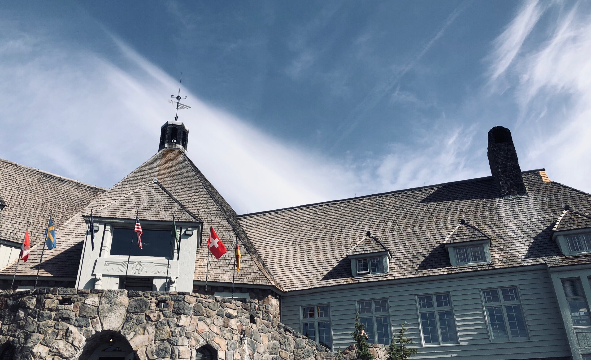
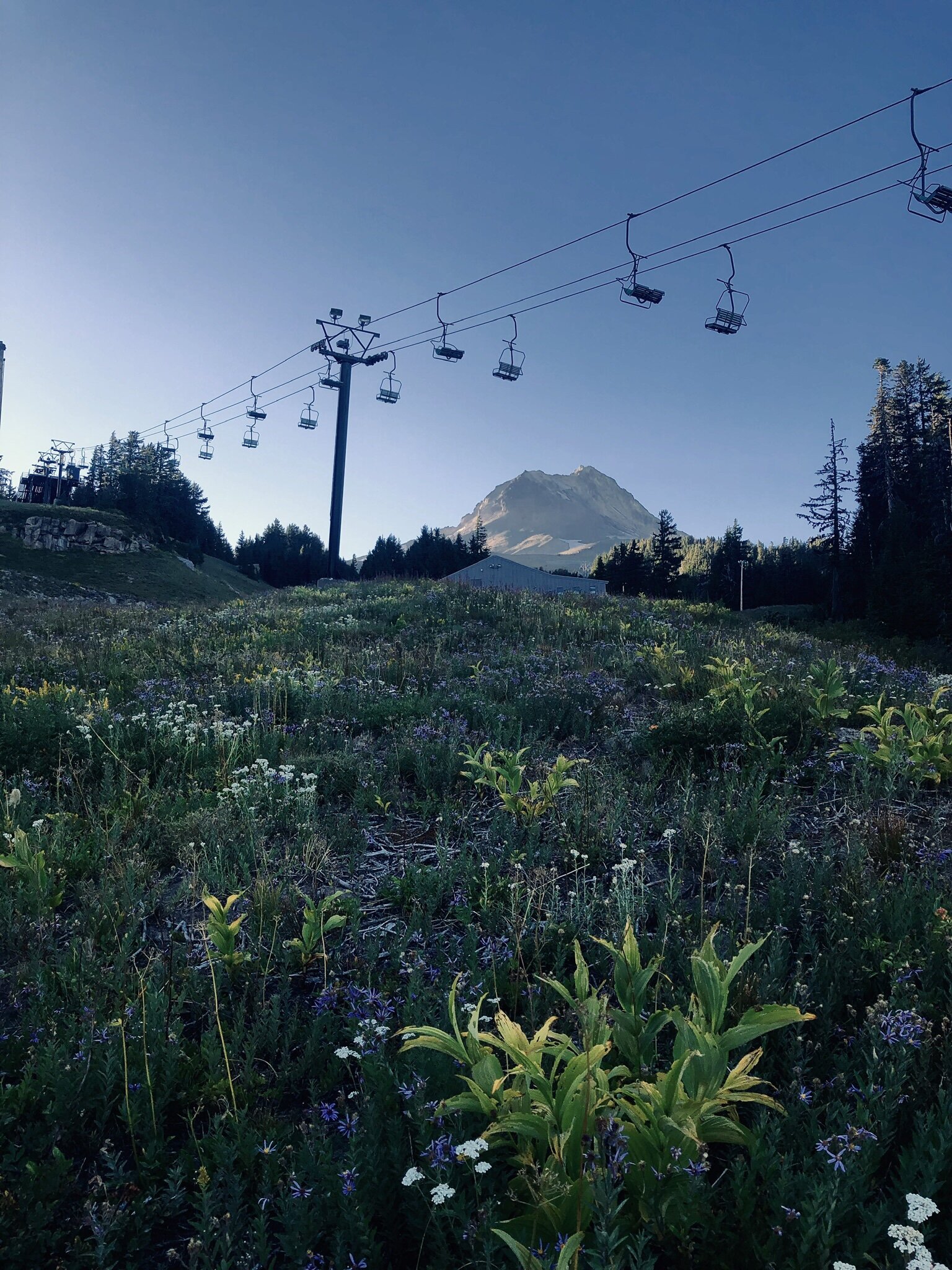
DAY ONE: TIMBERLINE LODGE to RAMONA FALLs
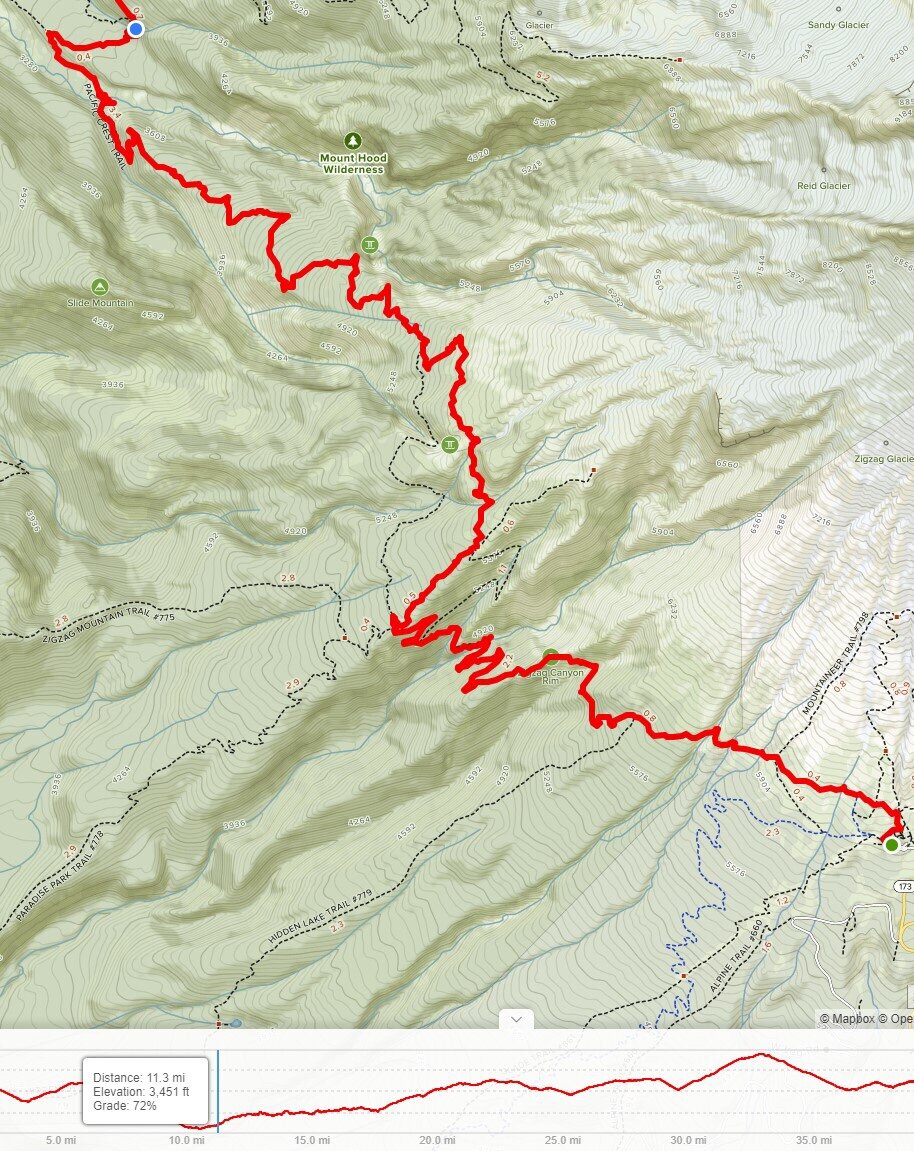
The day started slow, and our crew, my friends-Justin, Collin and myself- didn’t get to the Lodge until 1pm. With a late departure from Portland, plus a grocery store pit stop (and a McD’s breakfast break) we were hopeful to make it at least 10 miles for day one. The trail is 42 miles long, and if we planned to do the trip in a comfortable 4 days and 3 nights, we knew we needed to average at least 10 miles per day.
We kicked off from the parking lot and enjoyed a leisurely stroll for the first half mile to the trealhead, and the self-serve permit station. The permits for the trail and the backcountry camping are free, and up to 5(ish) people can be under one permit. Once you fill that form out, and put your copy somewhere dry and safe, the hike has begun. The first 10 miles or so, heading in the clockwise direction, follow the Pacific Crest Trail.
For those who may not have heard of the PCT, here is a good primer of that epic 2,650 mile trail.

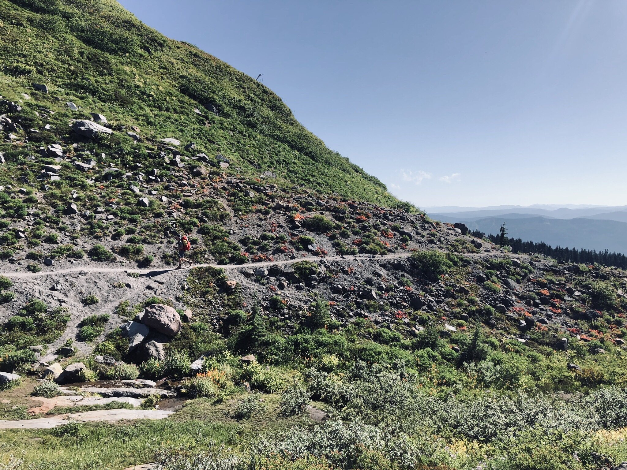
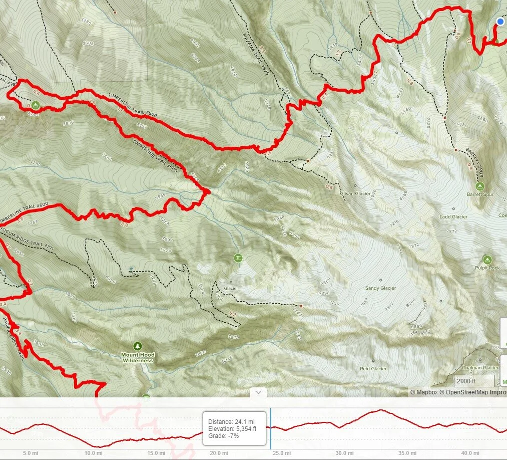
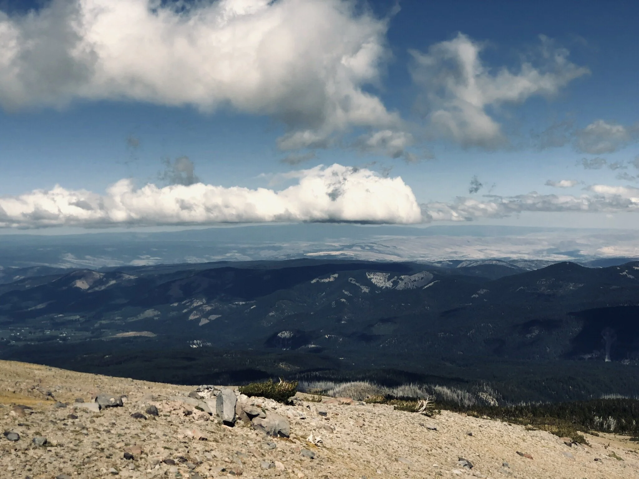
If you have never the Timberline Trail hike, put it on your list. Around every bend in the trail, down every valley and up each ridge, Mt. Hood delivers countless landscapes and breathtaking vistas. As you walk around the 11,249ft glaciated peak, climates change from lush forests to arid water-starved slopes and back again.
“Adopt the pace of nature: her secret is patience.”
-Ralph Waldo Emerson
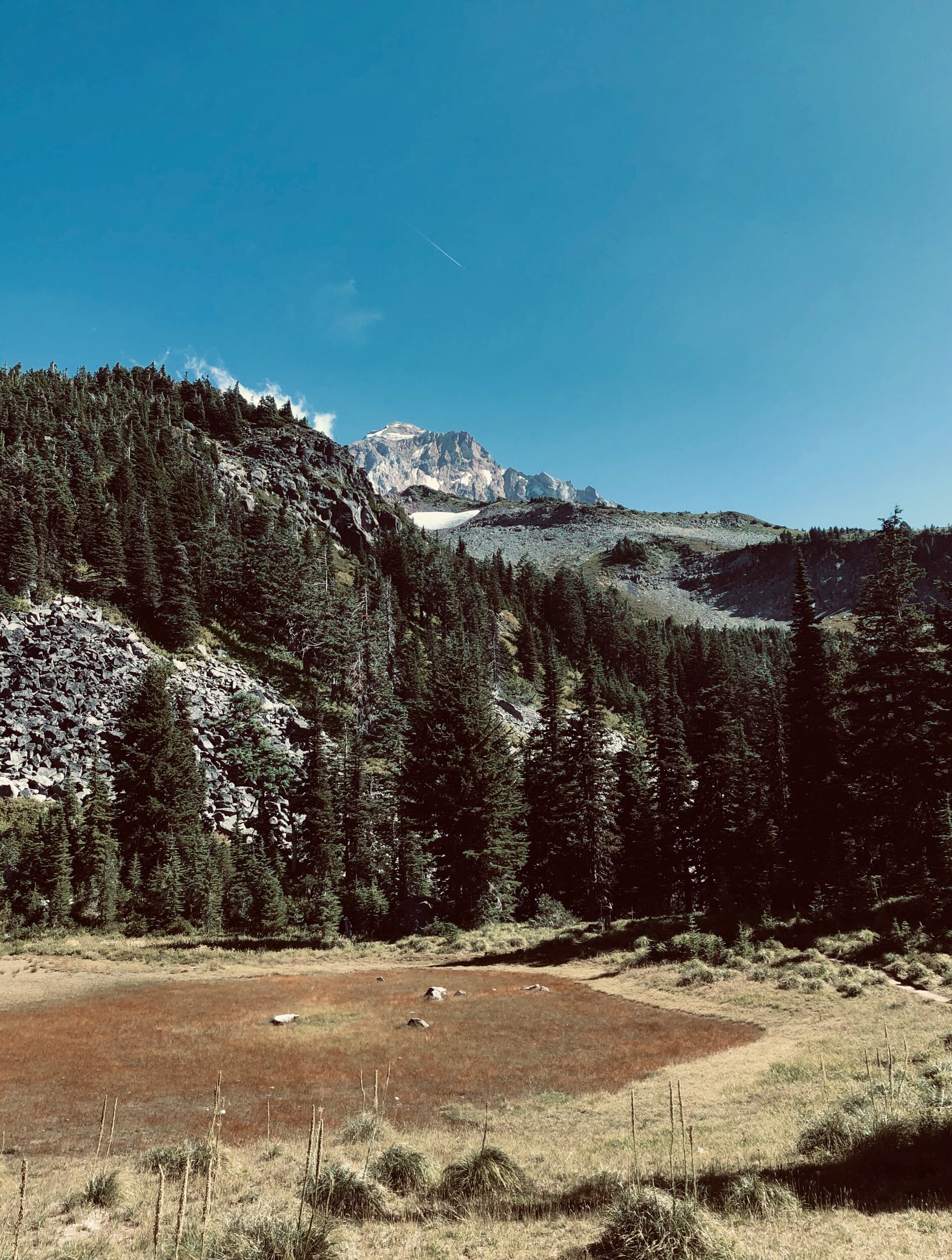
Sandy River
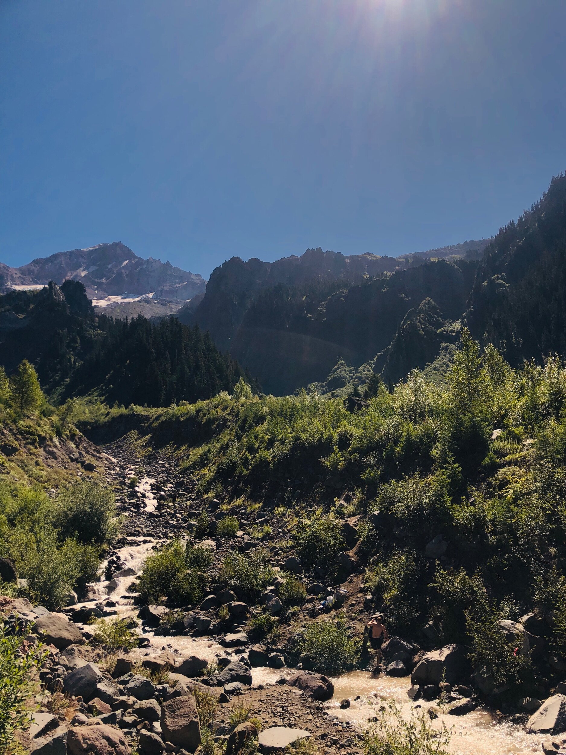
After 9 miles of hiking, our crew had descended 2,800ft -from the Timberline Lodge to the valley floor of the Sandy River. Note to you reader: this hike is FULL of river crossings. Depending on the season, these can vary from a small trickle that you can easily avoid, to rapids that require careful foot placements and impeccable balance to keep your feet dry.
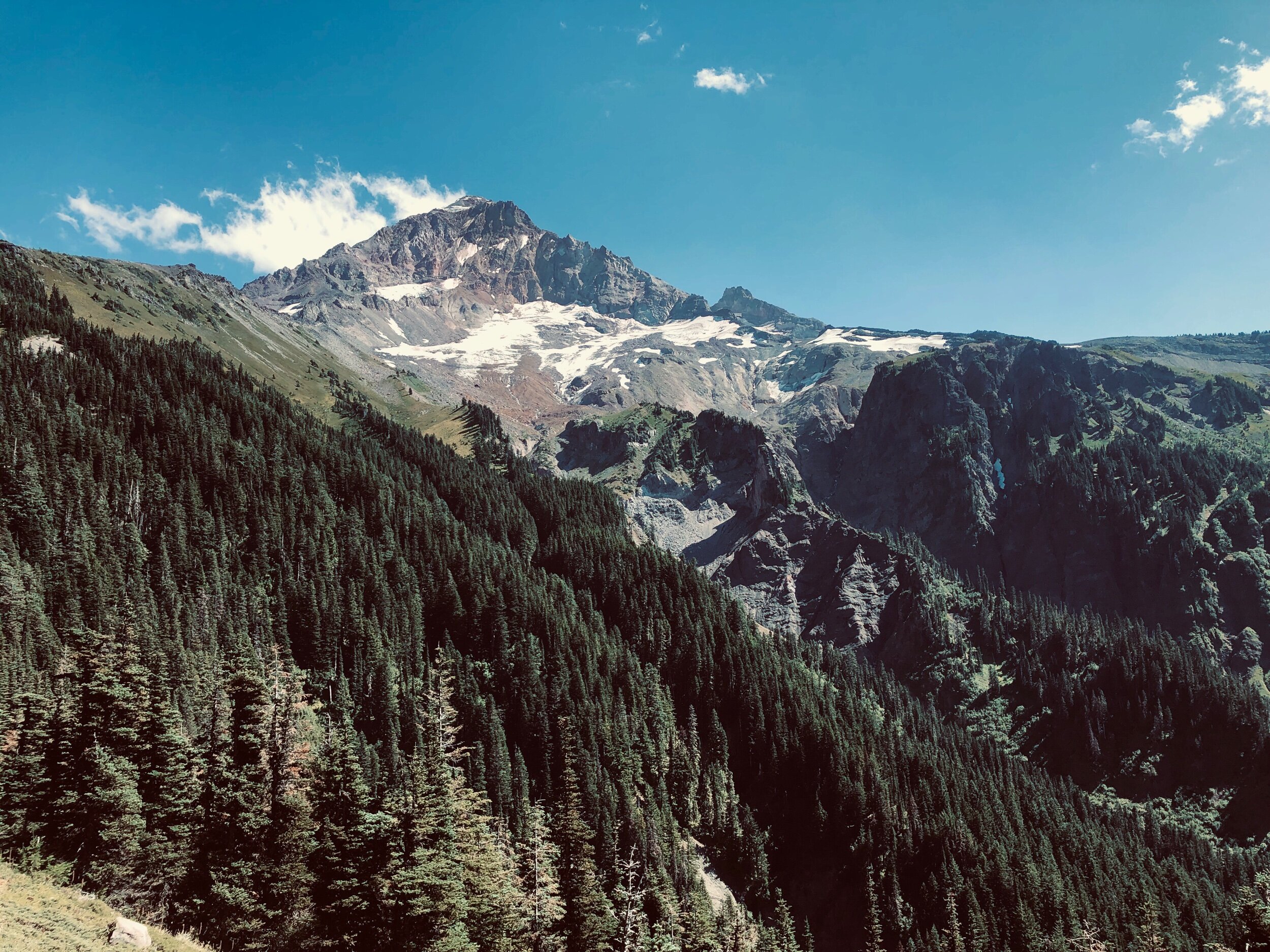
DAY TWO: RAMONA FALLS to ELK COVE
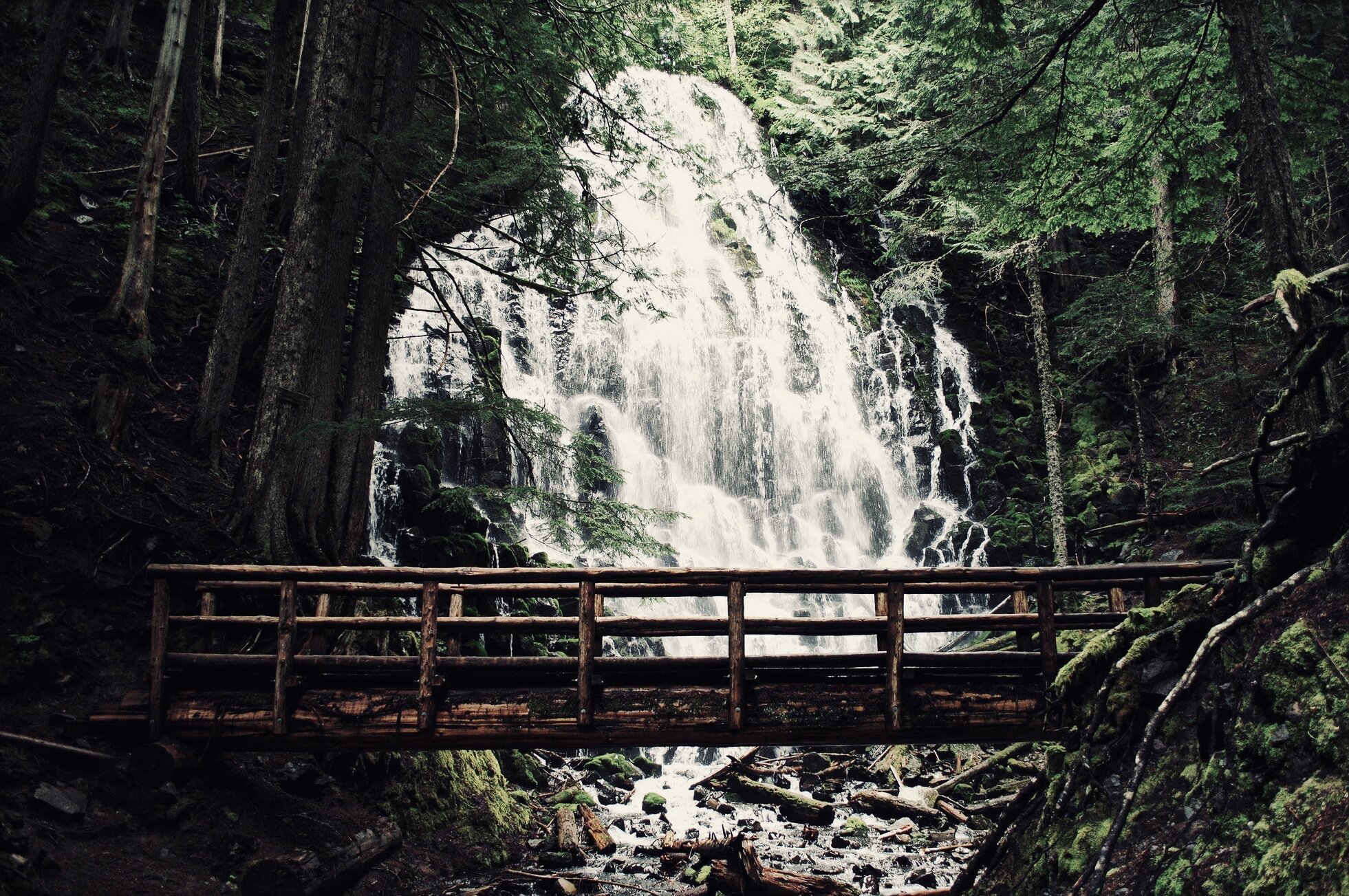
Photo by: Kathleen Walker
Muddy Fork River
Day two was a 13 mile push, from the base of Ramona falls to the valley floor at Elk Cove. The first 6 miles took us to the dog-leg around Bald Mountain and a much earned lunch break. The flies were buzzing, but not badly enough to make you pull your hair out. As the sun baked down, the miles ticked by while the mountain continued to show us all her good sides.
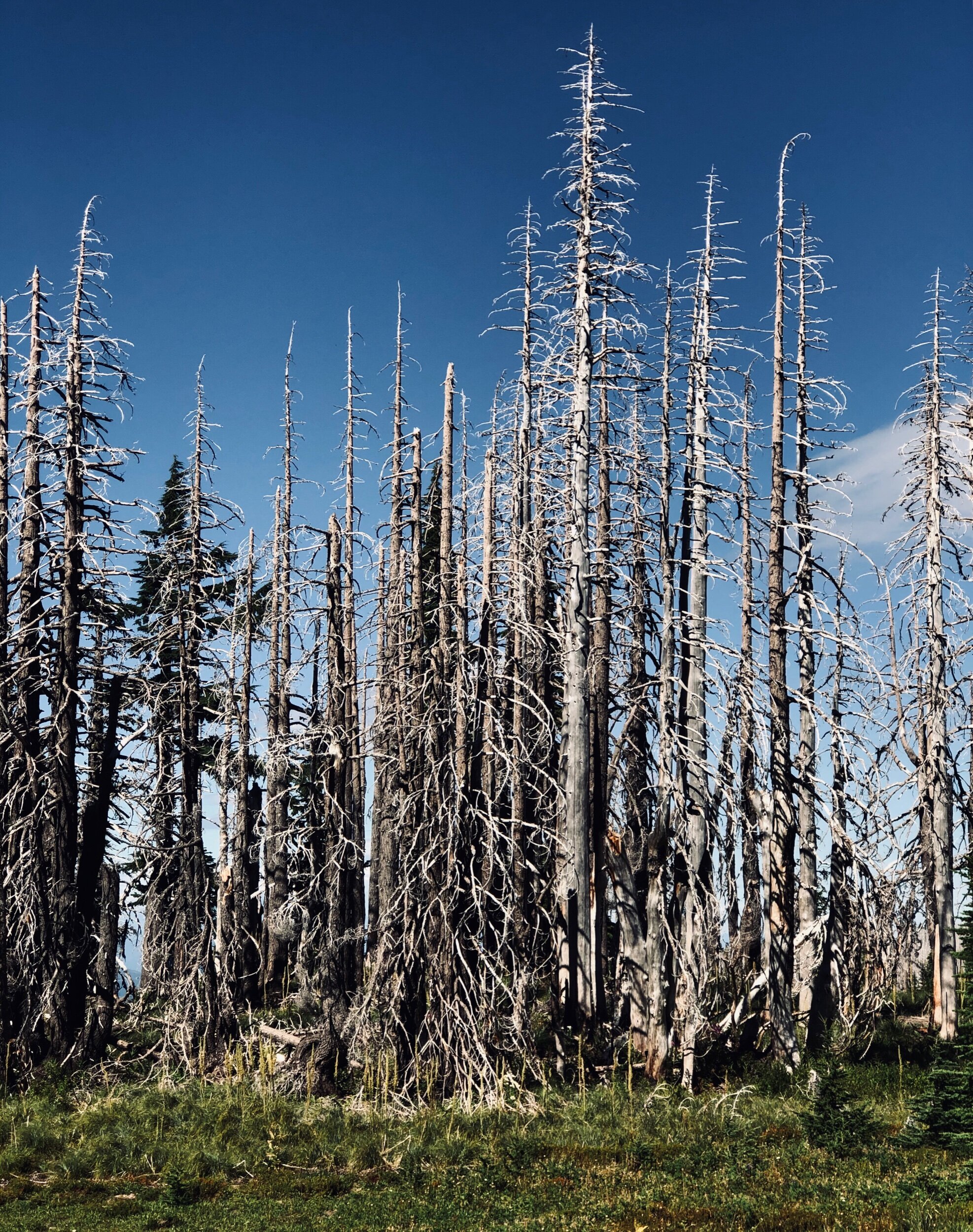
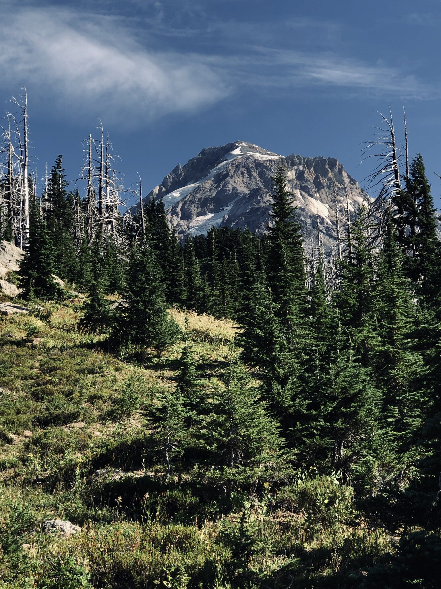
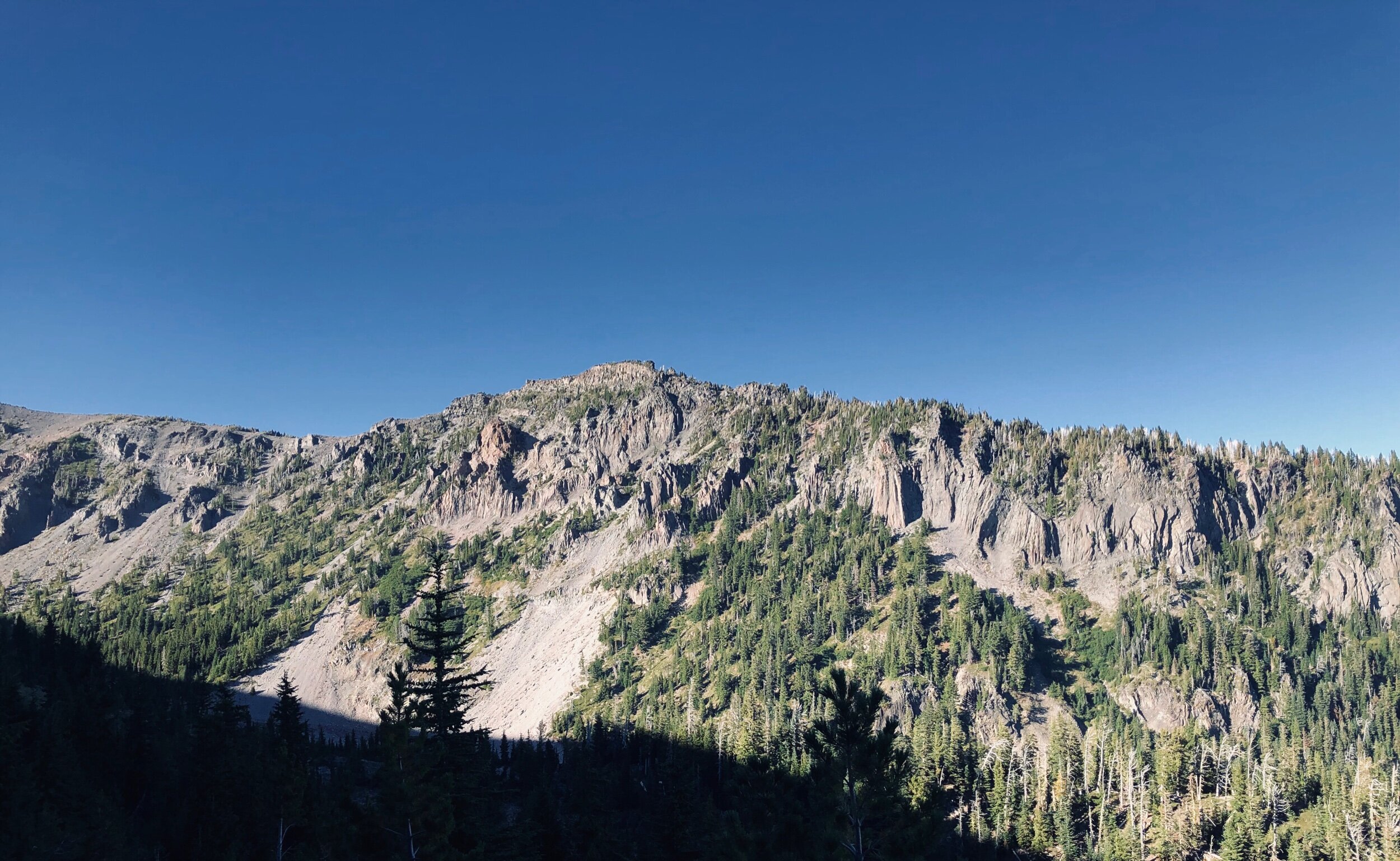
Throughout the day we passed through the erie slopes of past forest fires. The trees stood as sentinels against the winds blowing across the alpine pitches.


STORY TIME…
A quick story about communication. We did not go into this trip as complete novices. We’ve hiked miles and miles together, through multiple national parks, forests and mountains across the US. At the end of 2018, myself, my friend Justin and our friend Casey did a hike of the Mt. St Helen’s Volcanic Monument and the Whittier Ridge trail. You can read the full story here, but suffice it to say we learned we needed both navigational and communication redundancies with the outside world.
The mistake on this day was of a different nature. While we had our navigation on point, our communication piece was covered by two walkie-talkies. I had one, and Collin in the front had the other…however, Justin at the back of the line (only 5 minutes behind me was not carrying one of them 🙈
In the time that Collin and I went half a mile off trail to find camp…Justin, who was pulling up the rear (taking some incredible photos!) walked right passed us. For the next 30 minutes Collin and I split up again, with one heading north and the other, me, heading south. As I passed hikers heading counter-clockwise I continued to get updates that, yes, there was a guy matching our friends description booking it in the direction of Cloud Cap. Not Good.
As I rounded the bend to the Coe Branch river, a huge valley and 400ft climb stood before me. This was by far the largest vista I had come to while running to catch my fast-moving friend. So I stopped where I was, cupped my hands over my mouth and whistled as loud as I could…and scanned the horizon. Searching. A few seconds later I did this again, and again. On the third whistle, about a quarter of a mile away and nearly to the top of the opposite ridge, I saw a flicker of movement and color. It was Justin waving at me.
It took him 15 minutes to hike back to me, and another 45 for the two of us to meet back up with Collin a mile and a half back. Needless to say, everyone was a bit frustrated with our failure in communication, but in the end we were back together and dinner around the campsite was a little more delicious with the extra couple of miles of running and hiking; and plans were put in place to make sure that little slip up didn’t happen again.
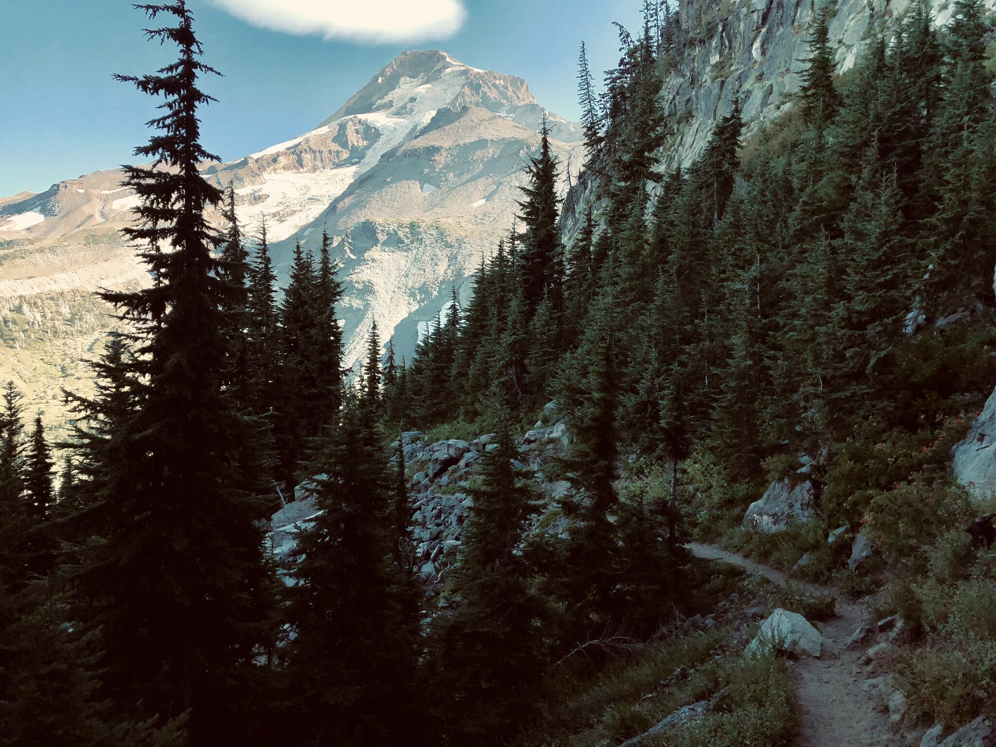
DAY THREE: ELK COVE to …
We awoke at our campsite the morning of day three with dew on our tents and fog hugging the mountain’s peak. After a brisk breakfast of oatmeal and coffee we started our trek for the day. The goal was to hike to Cloud Cap saddle by noon for a quick lunch stop, and press on to Newton Creek; a fourteen mile day.
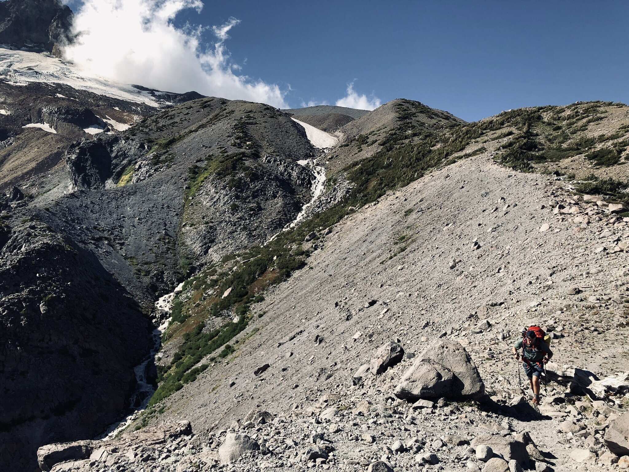
The morning hike to Cloud Cap was by far the best of the trip. The crisp air pushed at our backs as we climbed the 1,300ft from our site in Elk Cove to the campgrounds of Cloud Cap. This leg had two river crossings that tugged at the fear inducing machinations of my imagination; Coe Branch (30 minutes into the hike, where I had tracked Justin the day before) and Eliot Branch at the foot of the switchbacks up to Cloud Cap. Both were crossed with a thundering heart, and thank God, dry feet.
Photo by - Harley Cowan. Read his awesome story about the night he spent in the Inn here
After a quick calorie binge, and a bathroom break, we set out from the Cloud Cap saddle campground. A quick note, there is NO WATER at this campsite, nor at the inn itself. The Crag Rats have been working to get the well-fed spigot repaired but as of writing there is no water between the Eliot Branch and 7 miles south to Newton Creek. You may pass a few trickles of glacier run-off in the NE quadrant of the loop, near Cooper Spur, but do not rely on them. Ensure you have water before embarking on this leg.

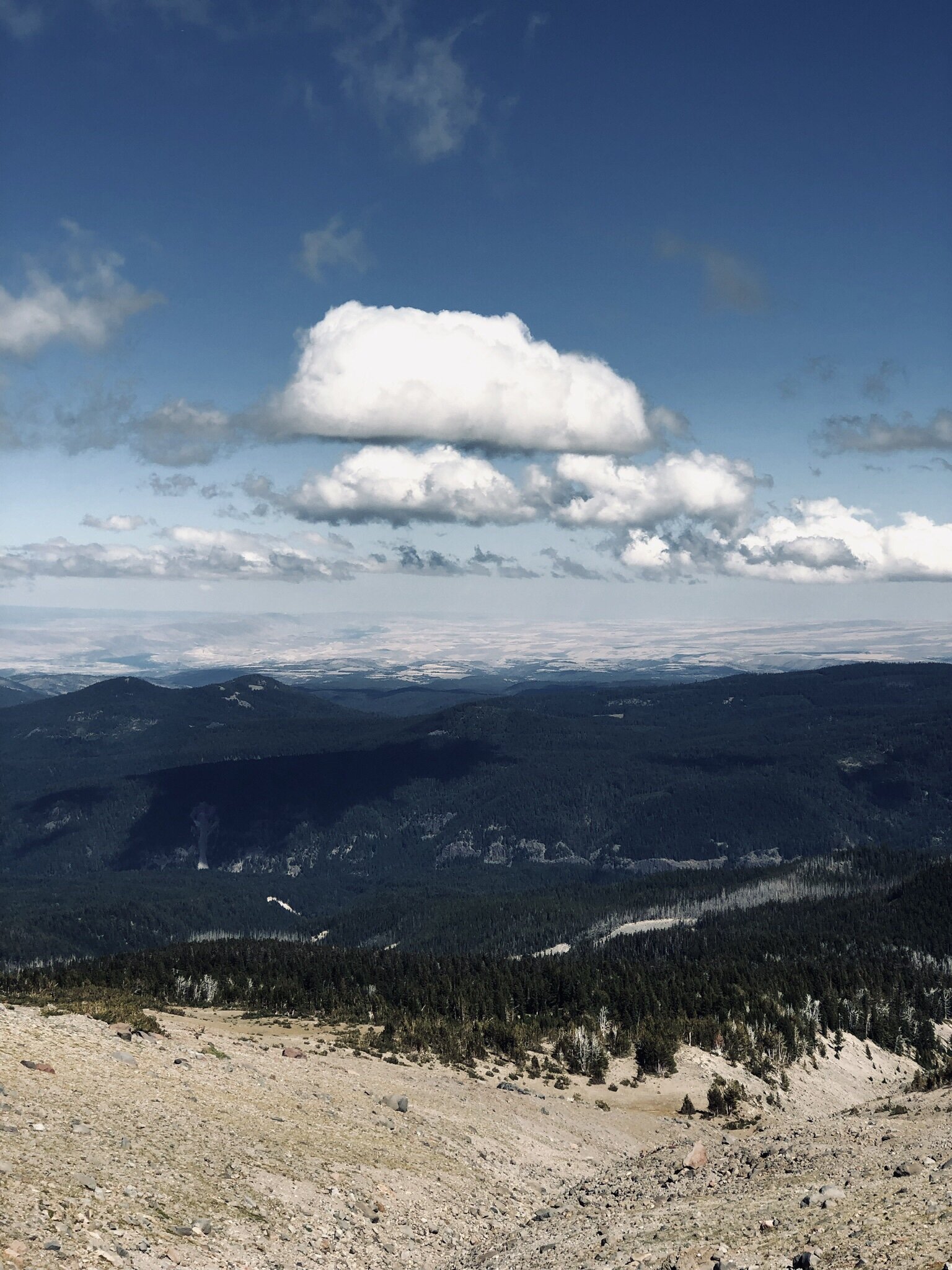
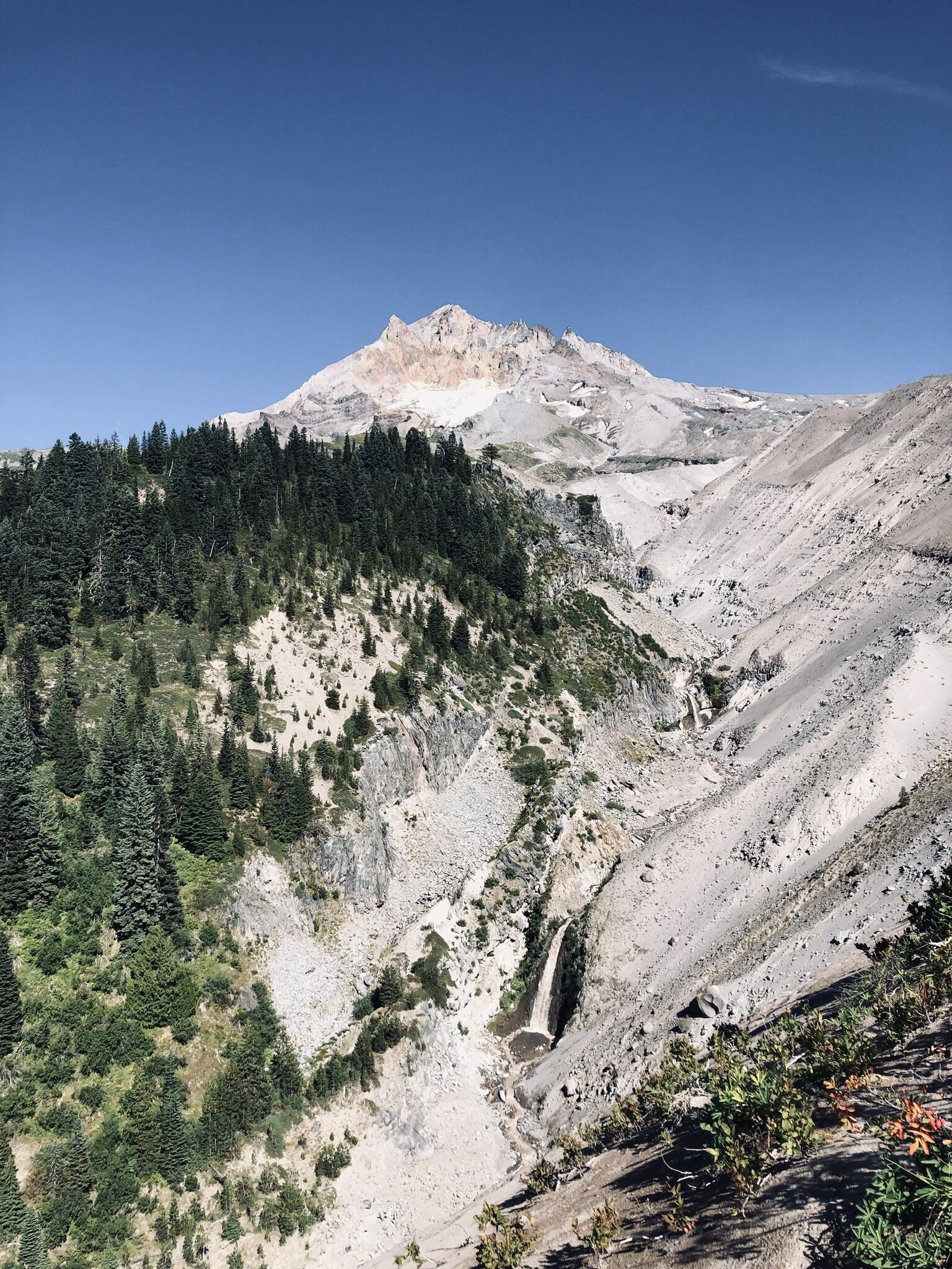
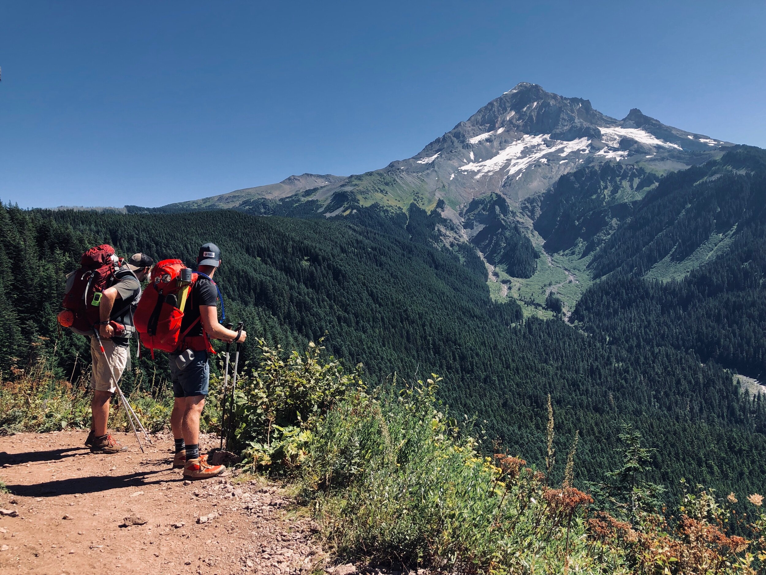
This segment was grueling and unexpected for this newcomer. The next two hours after lunch were like walking through a high desert. In the baking afternoon sun, we climbed nearly 2,000ft before our decent down the Gnarl Ridge. This windswept rocky landscape was barren and unrelenting in its punishment. Sunscreen was frequently applied and teeth were grit as one foot followed the other up these unforgiving slopes, to one of the most awe inspiring views of the trip.

The scale was impossible to capture, as 40+mph winds whipped our faces, and we stared, slackjawed at the thousands and thousands of feet of mountain before us.
“Oh, these vast, calm, measureless mountain days, days in whose light everything seems equally divine, opening a thousand windows to show us God.” – John Muir
The hike down Gnarl Ridge toward Newton Creek was a very welcome respite from the climbing we had been doing for the previous 2-hours. We made incredible time to the creek crossing, and while we were passing a large encampment of hikers settling in for the night, it was only 4 o’clock, and it was time I drop a bomb on my hiking companions.
You see, dear reader, for the last two days, I had been harboring a secrete goal to complete the trail in three days. Nights one and two, I was unable to convince the others to stretch the hike any further. But I knew I wanted to be able to spend my Monday holiday Netflixing and spending time with my dog. Plus, my dog-sitter was unable to spend the night on Sunday (our night three) with the pup and I was feeling pretty guilty at the idea of my pup spending the night alone. I mean, look at that handsome boy!
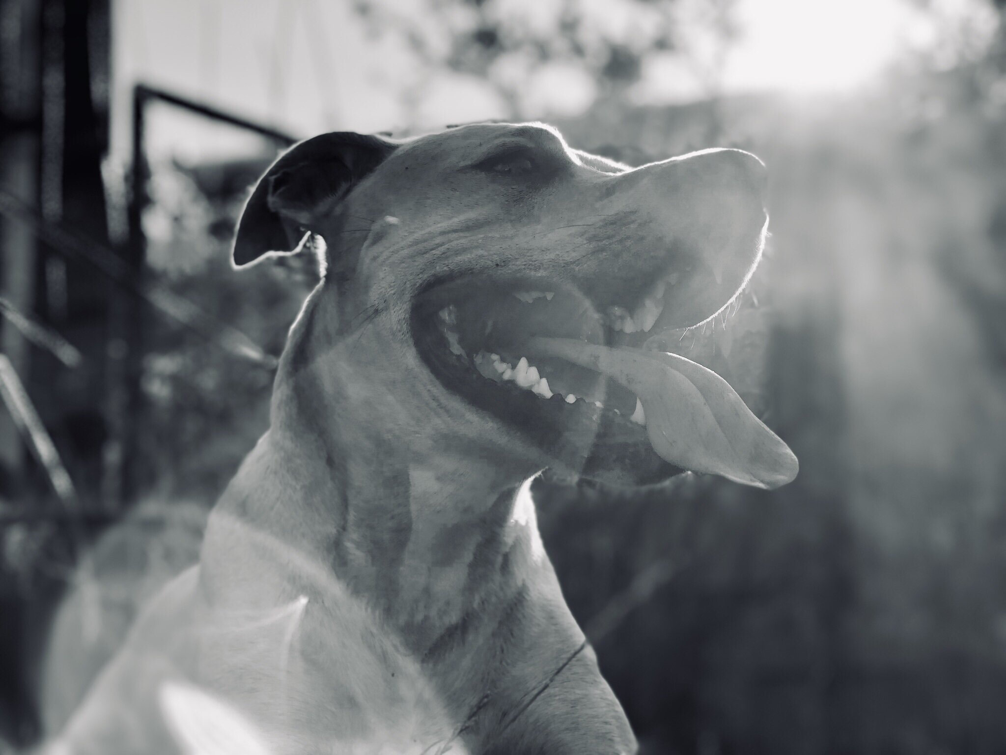
Picture of handsome Tucker for reference
So, I proposed we complete the hike, with the remaining nearly four hours of sunlight we had, and spend the night in our beds. And it gave us the added bonus, of being able to have a burger and a beer in Government Camp after the grueling task ahead.
It went as well as you might expect, but they were begrudgingly convinced! So we filled our water stores and set out, increasing our speed and heading for Timberline Loge and the end of the day.
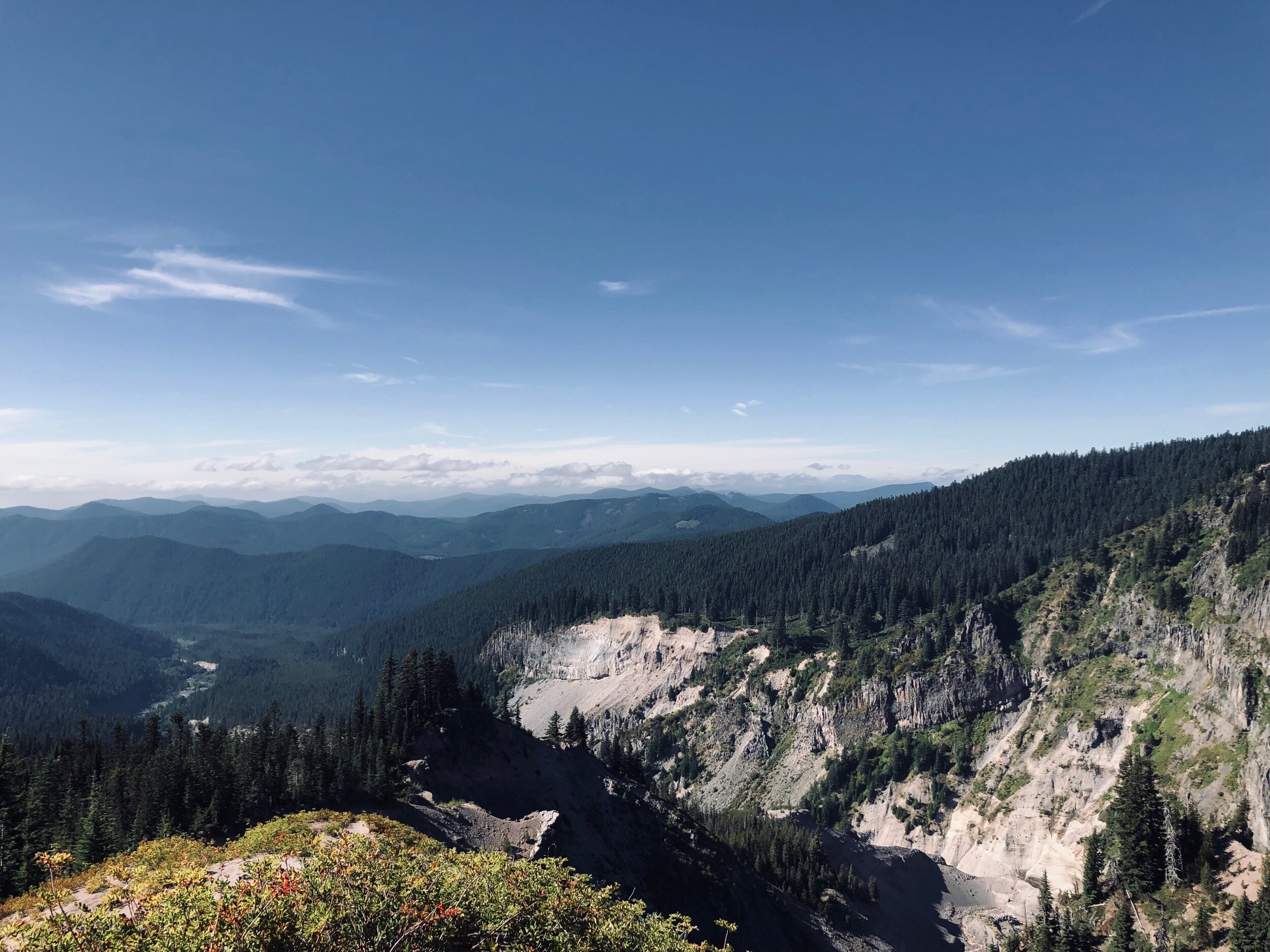
The next four hours were the hardest of the trip. I was only able to take a single photo, the one you see above, and focus on moving forward., We had much farther to go than I thought, not fully understanding the scale of the map. Approximately 8 miles and 2,200 feet of climbing were remaining before we would reach the parking lot and our ride home.
The final river crossing was the valley floor of the White River. This riverbed was MASSIVE! It was hard to imagine anyone fording that river in the spring with the snowmelt and rainwater, as we had a hard enough time finding a crossing of the river’s two separate legs with it’s low levels at the end of summer. Then the final push of climbing began. Again, poor map reading meant we ignorantly began the hike, unaware that we would have to climb 1,000ft to the parking lot 1.5 miles away. But, all in all, it was so SO worth it.
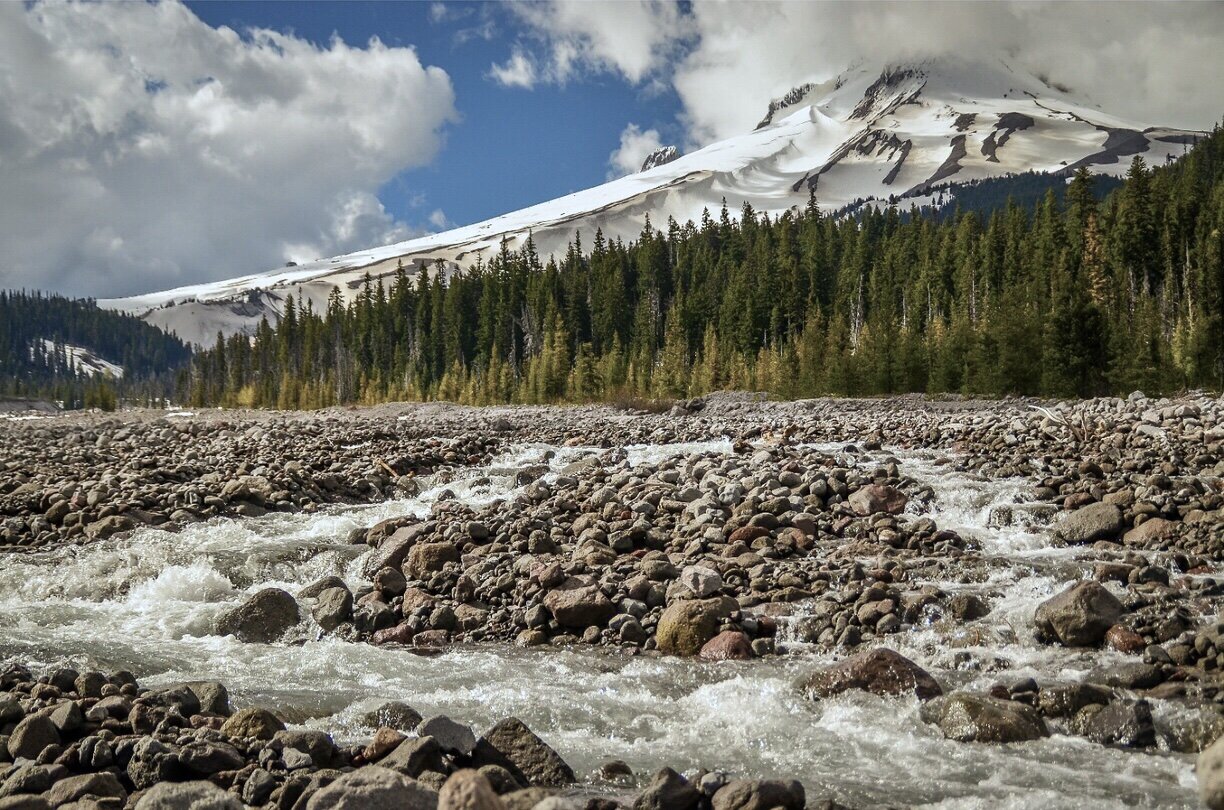
Photo by Thomas McEwen
